Arun River seems pushing Mount Everest higher
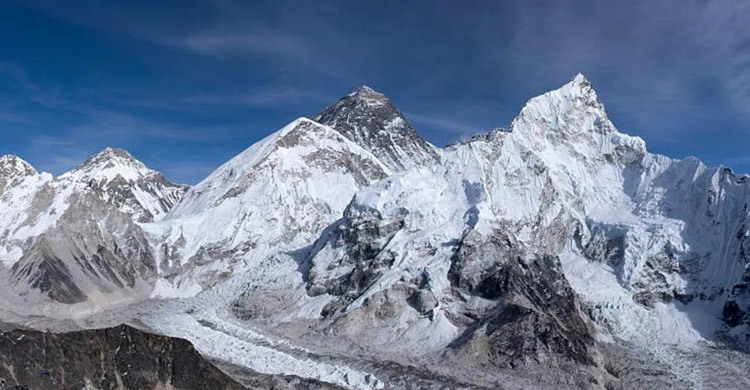
A new study suggests that Mount Everest could be 15 to 50 meters taller than it would be, thanks to erosion caused by the Arun River.
Researchers from University College London (UCL) have found that the erosion of rock and soil at Everest’s base by a river network may be causing the world’s highest peak to rise by up to 2 millimetres annually.
The study reveals that the loss of landmass in the Arun River basin, located 75 kilometres (47 miles) away, is lightening the Earth’s crust in the area, allowing Everest to "float" higher. "It’s like throwing cargo off a ship—the ship becomes lighter and floats higher," explained study co-author Adam Smith to the BBC.
While the ongoing collision between the Indian and Eurasian tectonic plates remains the main driver behind the rise of the Himalayas, the UCL team believes the Arun River's erosion is also contributing to the uplift of Mount Everest and nearby peaks.
Isostatic rebound: The science behind the growth
As the Arun River carves away rock and soil while flowing through the Himalayas, it reduces pressure on the Earth’s mantle—the layer beneath the crust. This process, known as "isostatic rebound," causes the thinned crust to rise upward, pushing Everest and other peaks higher. The research, published in “Nature Geoscience”, notes that this upward force is affecting not just Everest but neighbouring summits like Lhotse and Makalu, the world’s fourth and fifth tallest peaks.
"Everest and its neighbouring peaks are growing faster than erosion is wearing them down," said Dr Matthew Fox, a co-author of the study. "We can see them growing by about two millimetres a year using GPS, and now we understand more about what’s driving it."
Uncertainty and expert reactions
Some geologists not involved in the study find the theory plausible but caution that significant uncertainties remain. "Predicting river incision in such large catchments and linking it to surface uplift is difficult," noted Professor Hugh Sinclair of the University of Edinburgh, who emphasized that the UCL researchers themselves acknowledged the challenges in estimating these processes.
The Arun River originates in Tibet, flows into Nepal, and eventually merges with other rivers to become the Kosi, which meets the Ganges in northern India. It is a powerful river, capable of eroding vast amounts of material due to the steepness of the terrain it flows through.
The UCL study suggests that the Arun likely gained its current strength around 89,000 years ago, after "capturing" another water system in Tibet, allowing it to carve off even more material.
A dynamic Earth
Dr Xu Han of China University of Geosciences, the study’s lead author, described how the research highlights the dynamic nature of the Earth’s surface. "The interaction between the erosion of the Arun River and the upward pressure of the Earth’s mantle is giving Everest a boost, pushing it higher than it would otherwise be."
While there are uncertainties around the exact timing and scale of the river’s incision and its impact on Everest’s elevation, the study opens new avenues for understanding how natural forces, beyond tectonics, shape the world’s tallest mountains.