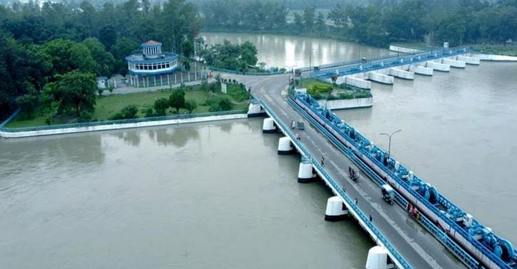
Teesta flowing above danger mark in greater Rangpur

The Teesta crossed its danger mark (DM) at Kawnia and Dalia points in greater Rangpur district creating a temporary flood satiation due to huge onrush of water from upstream during the last 24 hours ending at 9 am on Saturday.
Officials of Bangladesh Water Development Board (BWDB) said intensity of monsoon rains lessened in the upstream northwestern Indian states from today creating a possibility of no further deterioration of the situation during the next 24 hours.
"The Teesta was flowing above its danger mark by 41 cm at Kawnia point in Rangpur and 7cm at Dalia point in Nilphamari respectively at 9 am today," said Additional Chief Engineer for Rangpur Zone of BWDB Engineer Md Mahbubur Rahman.
Currently, all 44 gates of the Teesta Barrage Project are remaining open to control the huge water flow at Dalia point in Nilphamari where the river was flowing below its danger mark by 27cm at 3pm today.
However, the Teesta was flowing above its danger mark by 47cm at Kawnia point in Rangpur at 3 pm today.
Meanwhile, some low-lying and char areas alongside the Teesta in Nilphamari, Lalmonirhat and Rangpur districts went under floodwater amid torrential monsoon rains during the past few days causing sufferings to local residents.
"The flood situation might remain steady in low-lying areas of these districts during the next 24 hours," he said.
At the same time, water levels of the Brahmaputra-Jamuna river system continued to rise during the last 24 hours and might maintain the tendency in the Brahmaputra basin during the next 48 hours.
"We are closely monitoring the situation and ready to take immediate steps, if necessary, to save flood control structures on an emergency basis anywhere in Rangpur division under BWDB's Rangpur Zone," Rahman said.
Meanwhile, the Flood Forecasting and Warning Center (FFWC) of BWDB in a bulletin today said water levels of the Teesta may remain stable in the next 24 hours and the flood situation in the low-lying areas adjacent to Teesta basin may remain steady.
The recorded rainfalls during the last 24 hours till 9am today were 68mm rainfall at Cherrapunji and 35mm at Tezpur points in the upstream Indian states.
"During the same period, 114mm rainfall was recorded at Dalia point in Nilphamari, 125mm at Chilmari in Kurigram, 92mm at Kawnia in Rangpur, 90mm at Gaibandha, 82mm at Kurigram and 57mm at Rangpur monitoring points," the bulletin said.
The Dudhkumar was flowing below the danger mark by 42cm at Pateshwari, Dharla by 97cm below its danger mark at Kurigram and Brahmaputra was flowing below its danger mark by 72cm at Noonkhawa, 60cm at Hatia and 58cm at Chilmari points respectively at 9 am today.
The Jamuna was flowing below its danger mark by 45cm at Fulchhari, 83cm at Shaghata, 42cm at Bahadurabad, 51cm at Sariakandi, 64cm at Kazipur and 45cm at Sirajganj points at 9 am today.
Rangpur Divisional Commissioner Md Habibur Rahman said the district administrations, BWDB authorities, local monitoring committees and public representatives are closely observing the developing situation in the flood-prone areas.
"We have adequate preparations and the upazila administrations have ample stock of relief materials allocated earlier by the government through the district administrations to conduct relief operations when and where necessary," he added.
Source: BSS


