Cyclone Mocha makes landfall along Naf River coastlines

The "eye" or the centre point of most powerful cyclone Mocha in two decades made its landfall shortly after midday on Sunday in south-eastern coastlines ahead of the speculated timeline, making its way through the Naf River that divided Bangladesh and Myanmar.
"The 'eye' or the centre point of the cyclone made its landfall shortly after midday today on the Teknaf shorelines, coming through the Naf River, ahead of the time what we had speculated," Bangladesh Met office spokesman AKM Nazmul Huda today BSS.
But, he said, the tail or the rest part of the severe storm, which was categorized as very dangerous Cat 5 cyclone, might take more time to land or cross the coastlines.
Meanwhile, Upazila Nirbahi Officer (UNO) Mohammad Quamruzzaman of Teknaf, which visibly bears the worst brunt of the cyclone, said the wind was blowing at a speed of over 200 kilometres per hour in Teknaf and its southernmost part Shahpori Dip along the Bay of Bengal.
"The weather is frightening because of the very high velocity of wind but we are yet to see the much feared massive tidal surges," he said.
Saint Martin's island's union parishad Chairman Mujibur Rahman told BSS that the offshore coral island also witnessed heavy storms which appeared to have exceeded 200 kilometres per hour while out of its 10,000 permanent population, some 7,000 took shelters in hotels, motels alongside the regular cyclone shelters.
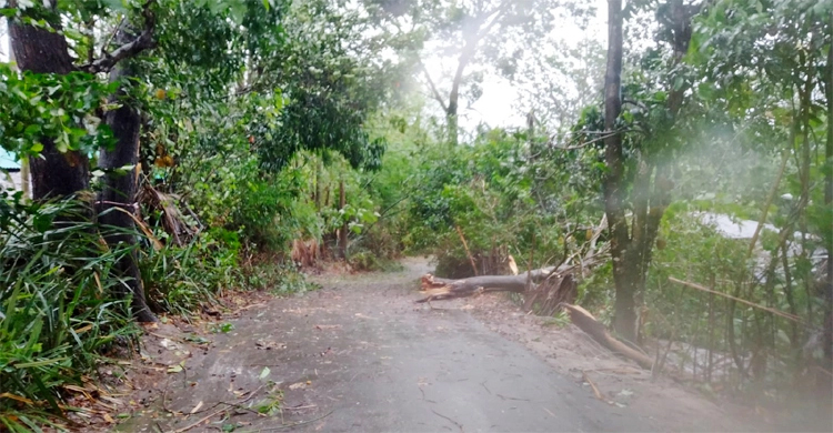
Both of them said they received no immediate report of any casualty but the storm uprooted many trees and damaged houses and other structures in Teknaf and St. Martins.
The weather officials said the Naf River witnessed high-tide that began at 11 am and continued until 5 PM, contrary to the low-tide in Cox's Bazar, which started at 9 am and continued till 3 pm.
The officials and residents in Cox's Bazar said cyclone Mocha has brought with it heavy rain and winds of up to 195kph (120mph) and feared it could trigger dangerous flooding on land along the Bay of Bengal.
The storm surges up to four metres swamped villages in low lying areas but tensions grew about amid speculations that the storm could ravage the world's largest refugee camp in Teknaf where over a million Rohingyas took makeshift refugees to evade persecution in their homeland in Myanmar.
"Many makeshift shanties in the Rohingya camp were leveled and trees uprooted by the severe storm," the government appointed relief and repatriation official Mizanur Rahman told BSS.
Bangladesh authorities earlier moved to safety some half a million people while many of the Rohingyas living in risky foothills were relocated amid fears of mudslides.
The met office issued its latest special cyclone bulletin at 3 PM saying the "the coast crossing very severe cyclonic storm mocha (pronunciation Mokha) moved north-northeastwards and weakened slightly".
“The centre of the system has crossed the Cox's Bazar-north Myanmar coast near sittwe (Myanmar) at 03 pm today (14 may 2023) and lies over the land area of Myanmar (lat. 20.5°n, lon 92.8°e).”
The bulletin said by the evening today the whole cyclone would completely cross the coast by and "weaken gradually".
Fresh warning
But under the influence of the system, northeast bay and adjoining area will experience maximum sustained wind speed of 120 kph rising to 130 kph in Gusts or squalls while maritime ports of Cox's Bazar was asked to keep hoisted great danger signal no 10.
The met office directed the Cox's Bazar, Chattogram and Payra seaports to keep hoist great danger signal no. 10 adding the signals would cover adjoining areas and offshore islands or chars.
Mongla port is to keep hoisted local warning signal number 4.
The coastal districts of Chattogram, Feni, Noakhali, Laxmipur, Chandpur, Barishal, Bhola, Patuakhali, Jhalokathi, Pirojpur, Borguna and their offshore islands and chars will come under great danger signal no. eight (r) eight.
River ports of Cox's Bazar, Chattogram, Feni, Noakhall, Laxmipur, Chandpur, Barishal, Bhola, Patuakhali, Jhalokathi, Pirojpur and Borguna were asked to keep hoisted riverine great danger signal no. 4 in a scale of four or highest for inland waters.
"Chattogram and their offshore islands and chars are likely to be inundated by the wind driven surge height of 5 to 7 feet above normal astronomical tide under the peripheral effect of very severe cyclone and steep pressure gradient," the bulletin said.
The low lying areas of coastal Feni, Noakhali, Laxmipur, Chandpur, Bhola and their offshore islands and chars are likely to be inundated by surges with heights from 3 feet to 5 feet above normal astronomical tide.
According to the bulletin, the Mocha was likely to cause heavy rain falls in Chattogram, Sylhet and Barishal ranging from 44 millimeter to 289 millimeter (mm).
"Due to very heavy rainfall landslide may occur at places over the hilly regions of Cox's Bazar, Bandarban, Rangamati, Khagrachari snd Chattogram," the met office warned.
It also asked all fishing boats and trawlers over North Bay to remain in shelter till further notice.
Source: BSS


